Fail:Irish Sea satellite image.jpg
Nadai resolusyen ke tinggi agi
Irish_Sea_satellite_image.jpg (436 × 576 piksel, saiz fail: 54 KB, jenis MIME: image/jpeg)
Penerang pandak
| Penerang |
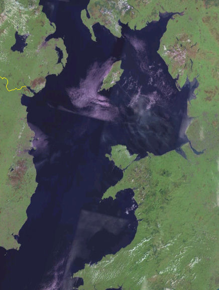
English: Satellite image of the Irish Sea from the NASA Blue Marble project.
Español: Mapa del Mar de Irlanda en el proyecto Blue Marble de la NASA. |
| Hari bulan | 15 Jun 2012, 19:49 (UTC) (upload date) |
| Bunsu |
This file was derived from: Irish Sea 4.82844W 53.54821N.png: |
| Pengarang |
|
| Ini adalah gambar sentuh, ini bermakna bahawa ia telah didigitalkan dari versi asal. Modifikasi: Cropped. Versi asal boleh dilihat di sini: Irish Sea 4.82844W 53.54821N.png. Modifications made by Dr Greg.
|
Pelisin
| This image is in the public domain because it is a screenshot from NASA’s globe software World Wind using a public domain layer, such as Blue Marble, MODIS, Landsat, SRTM, USGS or GLOBE.
|
 |
Log muat naik asal
This image is a derivative work of the following images:
- File:Irish_Sea_4.82844W_53.54821N.png licensed with PD-WorldWind
- 2005-05-20T19:09:05Z Jelte 992x653 (934277 Bytes) NASA [[World-Wind]] screenshot. {{PD-USGov-NASA}}
Uploaded with derivativeFX
Sejarah fail
Klik ba hari bulan/maya kena meda gamal fail nya maya nya.
| Hari bulan / Maya | Gambar mit | Dimensyen | Orang ngena | Komen | |
|---|---|---|---|---|---|
| baru | 03:54, 16 Jun 2012 | | 436 × 576 (54 KB) | Dr Greg | == {{int:filedesc}} == {{Information |Description={{en|Satellite image of the en:Irish Sea from the NASA Blue Marble project.}} {{es|Mapa del es:Mar de Irlanda en el proyecto Blue Marble de la NASA.}} |Source={{Derived from|Irish_Sea_4.8284... |
Guna fail
Tiada laman yang menggunakan fail ini.
Guna fail global
Fail tu dikena mega wiki-wiki tu:
- Guna ba af.wikipedia.org
- Guna ba azb.wikipedia.org
- Guna ba bh.wikipedia.org
- Guna ba ckb.wikipedia.org
- Guna ba de.wikipedia.org
- Guna ba el.wikipedia.org
- Guna ba en.wikipedia.org
- Guna ba fi.wikipedia.org
- Guna ba frr.wikipedia.org
- Guna ba he.wikipedia.org
- Guna ba hu.wikipedia.org
- Guna ba incubator.wikimedia.org
- Guna ba kk.wikipedia.org
- Guna ba la.wikipedia.org
- Guna ba mr.wikipedia.org
- Guna ba pl.wikipedia.org
- Guna ba pnb.wikipedia.org
- Guna ba rue.wikipedia.org
- Guna ba sr.wikipedia.org
- Guna ba sv.wikipedia.org
- Guna ba th.wikipedia.org
- Guna ba uk.wikipedia.org
- Guna ba vi.wikipedia.org